
King Charles III has officially opened a remarkable new footpath that traces the entire coastline of England, marking the creation of the world’s longest managed coastal walking route. This extensive trail, named the King Charles III England Coast Path, stretches an impressive 2,689 miles, providing a continuous pathway for walkers to explore England's diverse and stunning shoreline like never before.
The path, managed by Natural England — the government body responsible for its creation — offers a unique opportunity for people to experience the rich variety of landscapes that England's coast has to offer. From salt marshes and sandy beaches to towering cliffs, rolling dunes, and historic coastal towns, the route showcases the natural beauty and cultural heritage that define England’s maritime edges. Among the standout locations along the trail is the iconic chalk downland of the Seven Sisters in East Sussex, a dramatic and picturesque stretch of coastline that has also been designated a new National Nature Reserve, a status announced alongside the path’s inauguration.
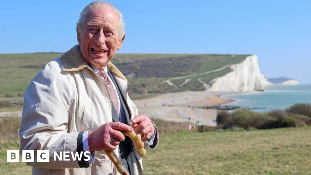
The inauguration ceremony took place at a reception hosted by the South Downs National Park Authority, where King Charles III officially opened both the coast path and the adjacent National Nature Reserve. Following the formalities, the King took to the trail himself, walking a section of the path at the Seven Sisters with notable figures including Tony Juniper, Chair of Natural England, and Environment Secretary Emma Reynolds. Juniper praised the path as a shining example of how public enjoyment, conservation, heritage, history, and community can harmoniously coexist, contributing to the well-being of millions.
While much of the coastal route was already in existence through various smaller paths and trails, the creation of the King Charles III England Coast Path involved significant expansion and enhancement. Over 1,000 miles of new paths were constructed, and many existing sections were upgraded to improve accessibility and safety. The work involved resurfacing trails, removing stiles to make the path easier to navigate, installing boardwalks over sensitive areas, and building bridges to maintain continuity. This ambitious project has spanned nearly two decades, initiated during the government of Gordon Brown and carried through the tenures of seven prime ministers before reaching this milestone. Currently, about 80% of the route is open to the public, with the remaining sections expected to be completed by the end of the year.
Neil Constable, who oversaw the project for Natural England, expressed enormous pride in the achievement, calling it “the best thing I’ll do in my working life.” For Constable, the significance of the path isn’t merely its length but the freedom it offers: wherever people live in England, they can now reach the coast and choose to walk alongside the sea for as far as they wish, turning either left or right and following a continuous route.
The establishment of this coast path required new legislation, specifically the Marine and Coastal Access Act of 2009, which provided the legal framework necessary to create and maintain a continuous public right of way along England’s coast. The act and subsequent planning efforts facilitated access to many areas previously closed off to the public, including beaches, dunes, and cliff-tops lying between the established trail and the sea. Importantly, the project also prioritized improving accessibility for people with reduced mobility, ensuring that more individuals can enjoy the scenic coastal environment.
One of the key challenges addressed by the project was filling in gaps within the existing network of footpaths. The aim was to bring the route closer to the shoreline wherever possible and to connect stretches of coastline that had never before been linked by a single continuous trail. However, there are a few unavoidable exceptions where walkers must leave the path briefly, such as crossing the Mersey River by ferry in northwest England. In south Devon, the River Erme presents a particularly tricky obstacle: without a bridge or ferry, and with upstream land privately owned and inaccessible, walkers must time their crossing to wade through the river during low tide, an experience described by Constable as “all part of the experience.”
Looking to the future, the path has been designed with climate change in mind. Recognizing that rising sea levels and increased coastal erosion will reshape England’s shoreline, the legislation includes a groundbreaking provision allowing the trail to be “rolled back” or moved inland if necessary. This flexibility aims to keep the path continuous and practical for generations to come, adapting dynamically to changing environmental conditions.
The practical benefits of this provision were demonstrated recently when a landslip caused by heavy winter rains in Dorset led to the closure of a section of the path near Charmouth. The