
A collaborative effort between the NASA Earth Science Education Collaborative (NESEC) and Earth to Sky (ETS)—a dynamic partnership involving NASA, the National Park Service, and various federal, state, and local organizations—is making significant strides in connecting millions of national park visitors with NASA’s Earth and space science. Central to this initiative is the Color-a-Pixel activity, a simple yet powerful tool that transforms intricate satellite imagery into accessible, collaborative art projects. This activity is helping park interpreters and outdoor educators bring NASA’s unique perspective from space into the hands and minds of visitors, enriching their experience and understanding of our planet and beyond.
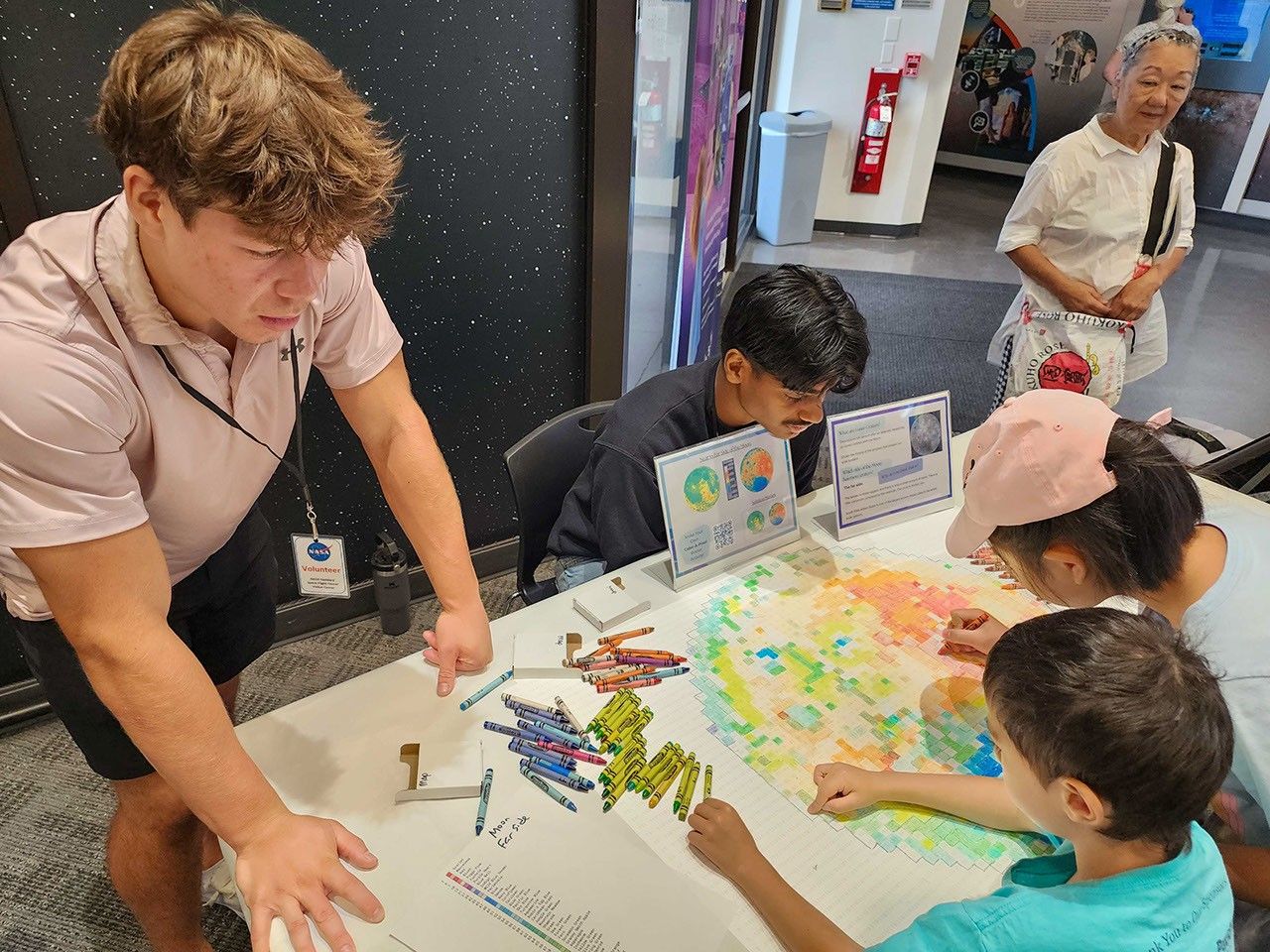
The Color-a-Pixel activity was developed by NESEC with the goal of making complex satellite data approachable and engaging. By converting detailed NASA satellite images into large posters composed of numbered squares—each corresponding to a specific Crayola crayon color—visitors can collaboratively “color in” a pixelated version of real satellite imagery. This approach allows participants to become actively involved in exploring scientific data, revealing stunning images from missions such as Landsat, the Mars Reconnaissance Orbiter (MRO), and the Lunar Reconnaissance Orbiter (LRO). The technology behind this transformation is provided by the Institute for Global Environmental Strategies (IGES), the lead organization within NESEC.
Brandi Stewart, Space Science Coordinator for Earth to Sky, highlights the activity’s appeal, emphasizing its simplicity and accessibility. She explains that all it takes is a crayon and a numbered guide to unlock the stories that satellites tell about Earth and other celestial bodies. Because the activity is low-tech and hands-on, it invites participation from people of all ages and backgrounds, making it a versatile tool for science communication.
Earth to Sky has integrated the Color-a-Pixel activity into its science communication training programs for park rangers and educators. During these workshops, facilitators set up the activity so participants can dive in quickly, coloring pixels and gradually revealing the full image. Geneviève de Messières, Earth to Sky Program Lead, notes that the activity fosters teamwork and serves as a stress-relieving, engaging exercise. As participants contribute their individual colors, the group collectively unveils the satellite image, creating a sense of shared accomplishment and discovery.
Beyond being a fun group exercise, Color-a-Pixel serves as an effective interpretive tool when used in public lands settings. While visitors engage in coloring, park rangers can share stories about environmental change, scientific concepts, and space exploration, weaving these narratives into the activity. The experience helps visitors understand that satellite imagery is not just about pretty pictures—it is rich scientific data that researchers use to monitor Earth’s environment and explore other planets. This fusion of art and science enables deeper connections with the natural world and the broader solar system.
Earth to Sky has deployed Color-a-Pixel at numerous public events and special occasions on public lands, engaging a wide range of audiences. Examples include community days, science festivals, visitor centers, and celebrations like International Observe the Moon Night. These events offer visitors hands-on experiences that connect them directly with NASA’s missions and data. To support educators and interpreters, pre-generated Color-a-Pixel posters are made available on the IGES website, ready for printing and use in diverse settings.
The partnership between NESEC and Earth to Sky exemplifies how complex scientific ideas can be communicated effectively to diverse audiences. Earth to Sky’s network of more than 2,000 interpreters and environmental educators collectively reaches millions of visitors each year at parks, refuges, and nature centers across the United States. This extensive reach amplifies the impact of Color-a-Pixel, making it a valuable addition to the science communication toolkit.
Theresa Schwerin, who leads NESEC, shares that the original inspiration for Color-a-Pixel was to create a simple tabletop activity for conferences and public events—something tactile that would spark conversations about NASA’s satellite data. Schwerin wanted to show participants that behind the beautiful images captured from space lies valuable data that scientists use to understand our world. Moreover, the activity opens doors to citizen science opportunities, inviting the public to contribute to NASA science by filling in additional details that complement satellite observations.
Andrew Clark, a data scientist and engineer at IGES, developed the Color-a-Pixel poster generator, refining it over time to enhance its effectiveness and user-friendliness. Schwerin recounts her experiences using the activity at public events, noting how children eagerly participate while parents watch and engage alongside them, turning the coloring