
**Underwater Archaeological Survey at Poompuhar: Unveiling the Lost Sangam-Era Port City**
In a significant stride for Indian maritime archaeology, the Tamil Nadu State Department of Archaeology (TNSDA) has successfully completed the first phase of an underwater archaeological survey off the coast of Poompuhar, located in the Mayiladuthurai district. This region, once known as Kaveripoompattinam, was a flourishing port city during the Sangam era—an ancient period celebrated in Tamil history for its literature, trade, and cultural achievements. The recent survey, carried out over twelve days in September and October 2025, reflects a renewed effort to unravel the mysteries of this submerged city and to understand its historical significance.
**Historical Background: The Port City of Kaveripoompattinam**
Kaveripoompattinam, or Poompuhar as it is known today, holds a prominent place in the annals of South Indian history. As a major port city during the Sangam period (approximately 300 BCE to 300 CE), it was a vibrant hub of trade, commerce, and culture. Ancient Tamil texts and literary works frequently refer to the city’s bustling harbor, cosmopolitan population, and its role as a gateway for maritime exchange with other civilizations, including those in Southeast Asia and the Roman Empire. Over time, however, the city suffered a series of catastrophic floods and erosions, leading to much of it being claimed by the Bay of Bengal. Today, much of Kaveripoompattinam lies submerged off the Tamil Nadu coast, sparking a deep interest among archaeologists to uncover its secrets.
**Objectives and Methodology of the Survey**
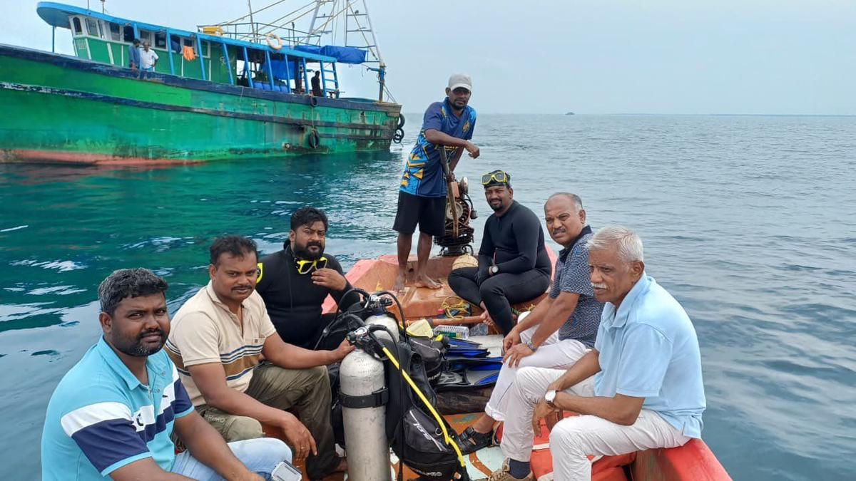
The latest phase of the survey was spearheaded by R. Sivanantham, Joint Director of the TNSDA, and involved a multidisciplinary team consisting of archaeologists and divers, including a four-member contingent from the Indian Maritime University. The team’s primary objective was to identify and document submerged archaeological remains, such as remnants of ancient structures, pottery, and other artifacts that could shed light on the city’s layout, trade practices, and eventual decline.
To achieve this, the team employed state-of-the-art marine exploration technologies. Among the instruments used were:
- **Remotely Operated Vehicle (ROV):** This underwater robot allowed the team to explore and document areas that were otherwise inaccessible or too deep for human divers. - **Side-Scan Sonar:** This device emits sound waves to create detailed images of the ocean floor, helping identify unusual features or “anomalies” that could indicate the presence of man-made structures. - **Sub-Bottom Profiler:** By sending sound waves beneath the seabed, this tool helps detect buried objects and layers, offering clues to both natural and human activities over time. - **Multibeam Scanner:** This advanced sonar system provides high-resolution, three-dimensional mapping of the sea floor, enabling precise documentation of detected anomalies.
By using this suite of equipment, the team was able to survey the seabed up to a depth of 23 meters. The operation was carefully timed between 10 a.m. and 3 p.m. each day, as sufficient sunlight is crucial for underwater visibility and the sea tends to become rougher in the late afternoon and evening.
**Logistics and Local Collaboration**
The logistics of the operation were supported by the local fishing community, whose knowledge and assistance proved invaluable. The archaeological team initially ventured out to sea on mechanized boats, after which they switched to smaller fiber boats to access specific survey points. This collaboration not only ensured the safety of the operation but also fostered a sense of community involvement in the preservation of local heritage.
Before embarking on the underwater mission, the divers and archaeologists underwent special training provided by a private agency. This preparation was essential, as underwater archaeological exploration requires a unique skill set, combining diving proficiency with expertise in handling sensitive scientific equipment and interpreting the data collected.
**Building on Past Research**
This latest survey is not the first attempt to uncover the mysteries of Poompuhar. Nearly thirty years ago, veteran archaeologist S. R. Rao led a pioneering underwater survey in the same region. Rao’s work was instrumental in identifying key underwater locations believed to be remnants of the ancient port city. The current TNSDA-led mission sought to revisit and further investigate several of these sites, utilizing modern technology to verify earlier findings and