
Hurricane Melissa is currently a slow-moving storm in the Caribbean Sea that is expected to rapidly intensify into a major hurricane, posing a severe threat to Jamaica and parts of Haiti this weekend. With its sluggish pace and escalating strength, Melissa is forecast to unleash extraordinary amounts of rainfall on the Caribbean islands, with some areas potentially receiving up to 40 inches of rain in just a few days. This volume of water is staggering—equivalent to the water in an Olympic-size swimming pool covering nearly the area of a football field—highlighting the alarming scale of the impending deluge.
While hurricanes are often associated with their destructive winds and storm surges, heavy rainfall is an equally perilous, though sometimes overlooked, danger. Historical events like 2017’s Hurricane Harvey demonstrate the catastrophic impact of hurricane-induced flooding, as Harvey set a record by dumping over 48 inches of rain near Houston, Texas. Similarly, last year’s Hurricane Helene caused severe flooding in Appalachia with rainfall totals reaching two feet shortly after the region had already been saturated by about one foot of rain. These precedents underscore the critical threat posed by torrential rain accompanying hurricanes, often resulting in devastating floods and landslides.
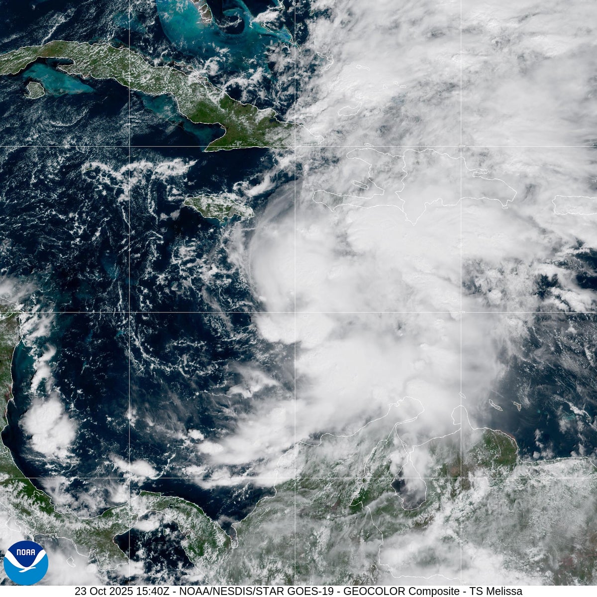
As of the evening of October 25, 2025, Hurricane Melissa was classified as a Category 1 hurricane, with peak sustained winds recorded at 90 miles per hour, according to the National Hurricane Center (NHC), part of the National Oceanic and Atmospheric Administration (NOAA). Despite an ongoing federal government shutdown lasting over three weeks, the NHC continues its operations monitoring the storm. Forecasters predict that Melissa will strengthen into a hurricane within 24 hours and rapidly grow into a major hurricane by Sunday, with the potential to escalate to a Category 5—the highest classification, indicating catastrophic wind speeds and destructive potential.
The trajectory of Hurricane Melissa is expected to shift northward early next week, bringing the most intense impacts to Jamaica as a major hurricane before moving toward Cuba by midweek. Afterward, the storm will likely move out into the Atlantic Ocean, reducing the threat to the mainland United States. However, the primary concern remains the severe weather conditions that will batter the Caribbean islands, especially Jamaica and parts of Hispaniola, where Haiti and the Dominican Republic are located.
One of the most troubling aspects of Melissa is its remarkably slow movement. Currently, the hurricane’s eye is advancing at just about three miles per hour—a pace slower than an average human walking speed. Brian McNoldy, a hurricane researcher at the University of Miami, emphasizes the danger this slow movement poses: “Getting hit by a hurricane is never good, but getting hit by a hurricane that’s not moving is so much worse.” The slow progression means that affected areas will endure hurricane conditions for an extended period, increasing the likelihood of catastrophic damage from both wind and rain.
This lethargic pace also contributes to the tremendous rainfall totals forecast for the region. The National Hurricane Center anticipates that Jamaica and the southern parts of Hispaniola could receive between 15 and 30 inches of rain, with some locations in Jamaica potentially exceeding 40 inches. Such intense rainfall can overwhelm drainage systems and lead to widespread flooding, threatening lives, infrastructure, and livelihoods. In addition to flooding, life-threatening storm surges of 9 to 13 feet above ground level are becoming increasingly likely along Jamaica’s coast, compounding the threat posed by the hurricane.
The increasing frequency and intensity of rainfall events associated with storms like Melissa are linked to the broader impacts of climate change. As global temperatures rise, the atmosphere can hold more water vapor, leading to heavier precipitation during storms. McNoldy explains, “That is the fingerprint that climate change has on storms—in general, more moisture, more rain.” This warming trend amplifies the destructive potential of hurricanes, making events like Melissa more dangerous and more frequent.
The geography of the Caribbean islands further heightens the risk. Jamaica and Hispaniola, known for their mountainous terrain, are particularly vulnerable to flash floods and landslides. When rainwater rushes down steep slopes and valleys, it concentrates in lower-lying areas, increasing the risk of sudden and severe flooding. Mountainous landscapes can also intensify rainfall through a process called orographic lift, where moist air is forced upward by the terrain, cooling and condensing to release additional precipitation. This phenomenon exacerbates the volume of rain falling in these regions, potentially triggering devastating flash floods. The tragic flooding in Appalach